VOYAGE HIGHLIGHTS
Connecting the Pacific and Atlantic Oceans, the Northwest Passage is a beautiful and unforgiving route, having claimed the lives of many explorers over the years. Since the late 15th century, the search for this fabled route through the Canadian Arctic was a holy grail for explorers. There are records of almost 40 expeditions that sailed these waters, either to explore this unknown territory or to find the sea route to Asia. The first recorded attempt was the voyage of John Cabot in 1497. The most famous journey here was James Cook’s failed attempt to sail the Passage in 1776, and of course the ill-fated Franklin expedition of 1834. The first to conquer the Northwest Passage by ship was Norwegian explorer Roald Amundsen. His expedition lasted from 1903 to 1906, on the converted herring boat Gjøa. On our Hurtigruten voyage, we sail in the wake of the great explorers to discover these renowned waterways.
The true north
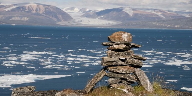
From Cambridge Bay, we venture into the Canadian Arctic Archipelago of Nunavut, starting our expedition into the heart and history of the Northwest passage. As we make our way through the icy waters you will be amazed by the vast expanses of pristine wilderness seen from the deck. We aim to visit several sites with traces of earlier expeditions. We will call at some of the world’s northernmost communities, explore legendary inlets and channels, and take you on exciting small boat cruising and landings. When conditions allow we will launch our kayaks or take you on hikes.
Then we cross the Davis Strait, as we reach Greenland you have the chance to discover some of the Greenlandic Inuit settlements and the UNESCO World Heritage site Ilulissat Icefjord, before the expedition ends in Kangerlussuaq.
Top of the world
Being at the top of the world means sailing in the midst of ice. On this voyage, like the voyages of the explorers before us, we will go where the ice allows. No matter where we sail or what we will see, we can promise a safe and thrilling expedition. After all, you will sail into the Northwest Passage, something few ships attempt even today.

Departs From
Montréal, Canada
The journey begins
Location: Montréal, Canada
Your expedition starts with an overnight stay in Montréal. While you are here, you have a chance to take in the photogenic 18th-century facades of Old Montréal before strolling along the Canal de Lachine. Discover the shops downtown before enjoying one of the most exciting food scenes in North America. Montréal is famed for Kamouraska lamb and Arctic char. Not to mention Poutine: fries covered in cheese curds and gravy. Montréal also offers irresistible patisseries, English pubs, Jewish delis and magnificent food markets reminiscent of Paris.
Explore
Location: Montreal/Cambridge Bay, Victoria Island
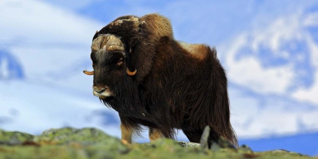
An early morning transfer will take you to the airport for your flight to Cambridge Bay. The community of Cambridge Bay is located on the southeast coast of Victoria Island. In Inuinnaqtun it is called 'Iqaluktuuttiaq', meaning a 'good fishing place.' The hamlet is located close to the Ekalluk River, which is famous for giant char. It is rich in archaeological history and blessed with abundant fish, seals, geese, muskoxen and caribou. Archaeological sites found all over this enormous island prove that indigenous peoples have been living in this part of the Canadian Arctic Archipelago continuously for the last four thousand years. Roald Amundsen visited the Cambridge Bay in 1905. In 1918 he traversed the same route back from west to east in his new ship called the Maud. The Hudson Bay Company purchased this vessel as a fur trading supply ship, arriving in Cambridge Bay in 1921. The Maud was used for years before it sank in the harbour. Its exposed hull has been a Cambridge Bay landmark for 80 years. An attempt is currently underway to re-float the vessel and return her to Norway. Wildlife abounds in this area with caribou, muskoxen and seals. This is where MS Fram is ready to take you into the Northwest Passage.
Explore
Location: Gjøa Haven
Gjøa Haven is a popular destination for fans of arctic history. The name honours the Norwegian explorer Roald Amundsen, who wintered here on the Gjøa Expedition. He called the place 'the finest little harbour in the world.' Amundsen and his men spent two years at Gjøa Haven, and they were busily engaged in collecting scientific data. Hunting caribou and exploring the surrounding area varied their work routines. When Amundsen arrived, there was no European settlement here. But he was in contact with the local Inuit and he learned a lot from them about survival and travel in polar regions. The local Inuit people, the Netsilik Inuit, are direct descendants of the ancient Thule people and they have lived in the area for over a thousand years. The John Ross expedition of 1829-1833 had previously visited this region and the ill-fated John Franklin expedition of 1845 perished nearby, so Gjøa Haven is often visited by arctic history buffs. Today the settlement is known for its vibrant arts and crafts scene, where carvers are famous for their renderings of shamanistic faces and talented seamstresses produce beautiful articles of Inuit clothing. It is also home to excellent cultural venues including the Heritage Centre, the Hamlet Centre and the Northwest Passage Territorial Trail. In the warm months when the tundra is covered with flowers and the sea is open, numerous arctic birds nest nearby, including loons, geese, ducks, terns, jaegers, plovers, snow buntings and snowy owls. A handsome herd of muskoxen lives on the island and there are some caribou too. When we arrive, we will be warmly welcomed to 'the finest little harbour in the world.'
Explore
Location:At sea
Enjoy navigating through the 180 km long and 50-65 km wide James Ross Strait. It is named after British Polar explorer James Clark Ross, and Roald Amundsen sailed here on the Gjøa Expedition. The strait runs between King William Island and the Boothia Peninsula and based on conditions at hand we will conduct landings for hikes or small boat cruising.
Explore
Location: At sea
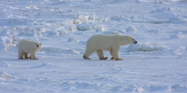
When arrive at Conningham Bay we will launch our tender boats and explore the bay. We hope for wildlife sightings, as this shallow, broad bay is a known hotspot for belugas and polar bears. The Bellot Strait is a narrow passage serving as the transit from Prince Regent Inlet to Peel Sound and Franklin Strait. To the south of the channel, you find the Boothia Peninsula - the northernmost point in mainland North America. The strait, about 2 km wide, has fierce currents that can run up to 15 km per hour. There may be the added navigational challenge of ice in the water. As a result, a careful assessment of the conditions on the day is required and the transit must be timed to avoid the strongest currents. No need to worry, though. MS Fram was purpose built as an expedition vessel with a 1B ice class, ship-depth sounding database, extractable forward-sounding sonar and iceberg search lights – and the Captain and his crew are experienced in sailing treacherous waters. We will continue looking out for wildlife. Remember the more eyes keeping watch, the bigger the chance of spotting the polar bear, which is often seen in this area. This strait is where the waters of the Pacific and the Atlantic oceans meet, after having crossed the passage we will be leaving the Pacific Ocean and enter the Atlantic Ocean.
Explore
Location: Fort Ross
At the end of the channel is historic Fort Ross, a trading post established by the Hudson's Bay Company in 1937. There are still two small huts ashore that are maintained by the Canadian Coast Guard, occasionally used by the local Inuit for shelter during hunting trips.
Explore
Location: Beechy Island and Radstock Bay
Our first stop today is Beechy Island. This place is closely linked to the history of exploration of the Northwest Passage. The most famous voyage, one surrounded in mystery, is the British expedition led by Sir John Franklin. Two ships sailed into the passage in 1845, but neither the ships nor any of the 129 crewmembers were ever seen again. It is known that the Franklin Expedition over-wintered on Beechy Island in 1845-1846. Three graves on the shore (plus another from one of the search parties) is proof of the unfortunate outcome for the expedition members. As you go ashore, you will see the graves and the remains of Northumberland House, built by the rescuers searching for Franklin and his men. The desolate location of the graves and the ruins of Northumberland House create a haunting reminder of the incredible challenges faced by explorers in this powerful wilderness. Next up is Radstock Bay. It is dominated by the striking landmark Caswell Tower - a prominence of sedimentary rock rising from the sea. The shoreline around Caswall Tower is a good location for short walks to a pre-historic Inuit dwelling site. Caswall Tower features a challenging hike to the summit for great views over the surrounding area. The summit is the location of a small station used seasonally for polar bear research.
Explore
Location: Landcaster Sound and Devon Island
Devon Island is the largest uninhabited island on Earth (Antarctica is counted as a continent). We arrive at Dundas Harbour, an abandoned settlement with an old Royal Canadian Mounted Police camp and several archeological sites. Come shore to see the ruins of some of these buildings, along with an impressive Thule site. The people who lived here was the ancestors of the Inuit. West of Dundas Harbour is Croker’s Bay, a large fjord with two tidewater glaciers at the head of the bay. The area is rich in wildlife and as with any expedition in the Arctic, the search for natural encounters is part of the experience. We may see several seal species such as walrus, beluga or even narwhal. Polar bears are frequently seen in the area and the tundra around the shore supports small populations of Arctic hare and musk ox. This is a perfect place for small boat excursions to see marine life and glaciers up close.
Explore
Location: Pond Inlet, Baffin island
In the morning, we will head further south and cruise the spectacular Arctic landscape of Eclipse Sound, before we arrive in Pond Inlet. Explorer Sir John Ross named Pond Inlet in 1818 for John Pond, a renowned British astronomer. Today the picturesque hamlet, also called 'Mittimatalik' in Inuktitut, is a traditional Inuit community, located on the northern tip of Baffin Island, near the eastern entrance to the Northwest Passage. Pond Inlet is surrounded by mountain ranges, with several dozen glaciers, scenic fjords and inlets, ice caves, geological hoodoos and drifting icebergs. As we arrive, we sail through a pretty channel flanked by the peaks and glaciers of Baffin and Bylot Islands. At these latitudes the sea is frozen for most of the year, only opening up in July for a short late-summer season. This is where the search for high Arctic wildlife, such as polar bears, can begin. Pond Inlet is also a great place to see large pods of narwhal. Pond Inlet has a small visitor centre, and the cultural performance by the local community will be a highlight.
Explore
Location: At sea
We cross the Davis Strait, a northern arm of the Labrador Sea. This strait was named for the English explorer John Davis, who led three expeditions in the area between 1585 and 1587. He was looking for a route through the North West Passage, and he discovered the Hudson Strait. Davis was the first to draw attention to seal hunting and whaling possibilities in the Davis Strait, and to show that the Newfoundland cod fisheries extended this far north.
Explore
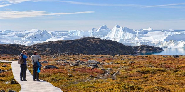
Location: Ilulissat
Our first stop in Greenland is Ilulissat. When you come ashore, you will have your first chance to compare life in a settlement in Greenland with that you have seen in the Canadian Arctic. The town is set in the stunning scenery of the Ilulissat Icefjord, a UNESCO World Heritage Site. Just outside the town, at the mouth of the fjord, you can often see enormous icebergs that have run aground. They originate from the Jakobshavn Glacier, one of the most productive glaciers in the Northern Hemisphere. The icebergs make their way down the 20 km fjord before entering Disco Bay. Marvel at the changes in hue of the ice when the iceberg surface is struck by the Midnight Sun. Hear the icebergs’ soundtrack of cracking and rumbling, as the sounds echo from one end of Ilulissat to the other. We offer a variety of options for viewing the Icefjord. A short walk through town will bring you to the head of a network of short trails that take you to the shores of the fjord. There are also options to get out on the water to see the ice and maybe whales from local boats, or to get high up for an aerial view with flightseeing trips by fixed wing aircraft or helicopter.
Explore
Location: Sisimiut
En route to Sisimiut, we encourage you to be out on deck to scout for whales. The waters close to the settlement are frequented by several species, such as humpback and fin whales. Harbour porpoise and minke whales can be encountered along the west coast of Greenland. If we are lucky, we might also see large numbers of seals, the most common being the harp seal. Sisimiut is situated 40 km north of the Arctic Circle. It is a modern settlement that maintains ancient traditions. Come ashore to explore the colourful town; visit the small museum, hike in the hills and shop for local handicrafts. Just across Disco Bay is the Disco Island and settlement Qeqertarsuaq. This is where the Gjøa Expedition and the second Fram expedition stopped to get dogs and other equipment on their way to the Northwest Passage.
Explore
Location: Copenhagen/Kangerlussuaq
Kangerlussuaq means 'big fjord' and, MS Fram will sail almost the entire length of the fjord (190km) before reaching the town. As we arrive in Kangerlussuaq, the expedition is over. After debarkation you will join a final excursion to the Greenland Ice Sheet. This vast icy wasteland stretches 1,500 miles north and reaches heights of up to 3,200 metres above sea level. The road to the edge of the Ice Sheet boasts beautiful natural scenery, ranging from Arctic desert and tundra with low growing shrubs, to hilly terrain offering breathtaking views over the landscape. Your plane to Copenhagen leaves late in the evening.
Explore
Location: Copenhagen
You arrive in the Danish capital early in the morning and may even have the time to explore "Wonderful, Wonderful Copenhagen" before you head home.
Location
Copenhagen
Pricing Info
Price includes
- Hurtigruten Expedition in cabin grade of your choice on a full board basis
- Overnight in Montreal before the voyage including breakfast
- Transfer hotel to airport in Montreal
- Economy flight Montreal to Cambridge Bay
- Transfer airport to ship in Cambridge Bay and ship to airport in Kangerlussuaq
- Excursion towards Icecap incl. dinner after the voyage
- Economy flight Kangerlussuaq to Copenhagen
- Wind- and water-resistant jacket
- Landings with small boats and activities on board and ashore
- Professional English-speaking Expedition team that gives lectures as well as accompany landings and activities
- Free tea and coffee
Price does not include
- International flights
- Travel insurance
- Luggage handling
- Optional Excursions and Gratuities